Could you use a reminder of simpler times? Drive along some back roads in the Lehigh Valley in eastern Pennsylvania, and you’ll find covered bridges that date back to the mid-19th century. They’re a beautiful reminder of our country’s past. Once the United States had about 10,000 covered bridges. Today, there are fewer than 1,000 nationwide.
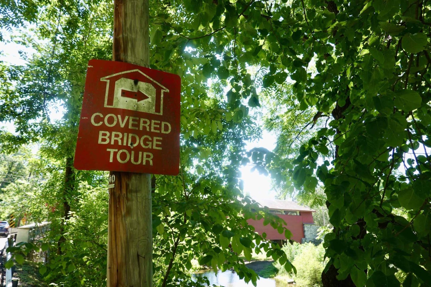
There are 7 covered bridges in the Lehigh Valley. Several of them are surrounded by trails and parks, allowing visitors to enjoy hiking, biking, or picnicking.
While in the Lehigh Valley, also consider visiting Bethlehem or Hawk Mountain Sanctuary. You’ll have some great hiking options and be treated to amazing miles-long views over the valley.
Covered Bridge Facts
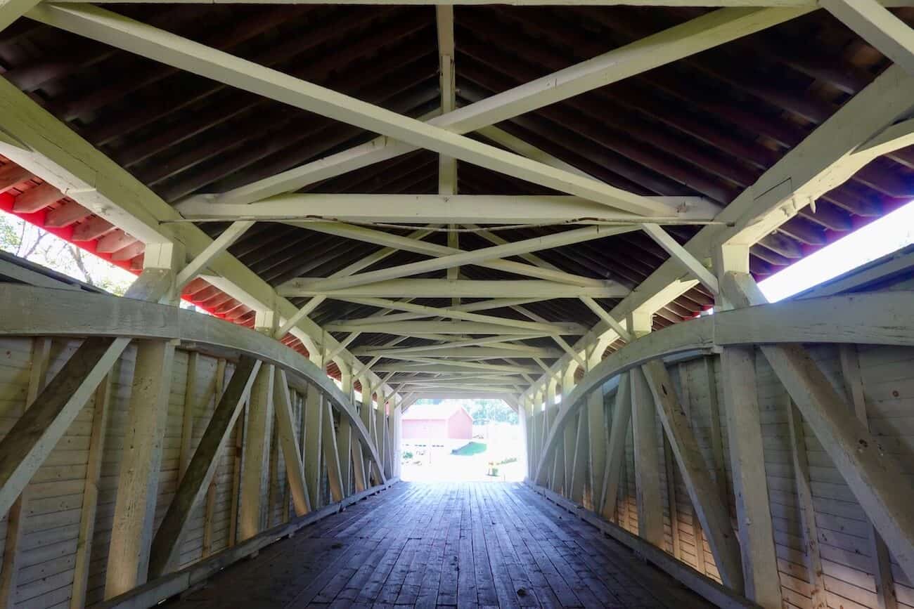
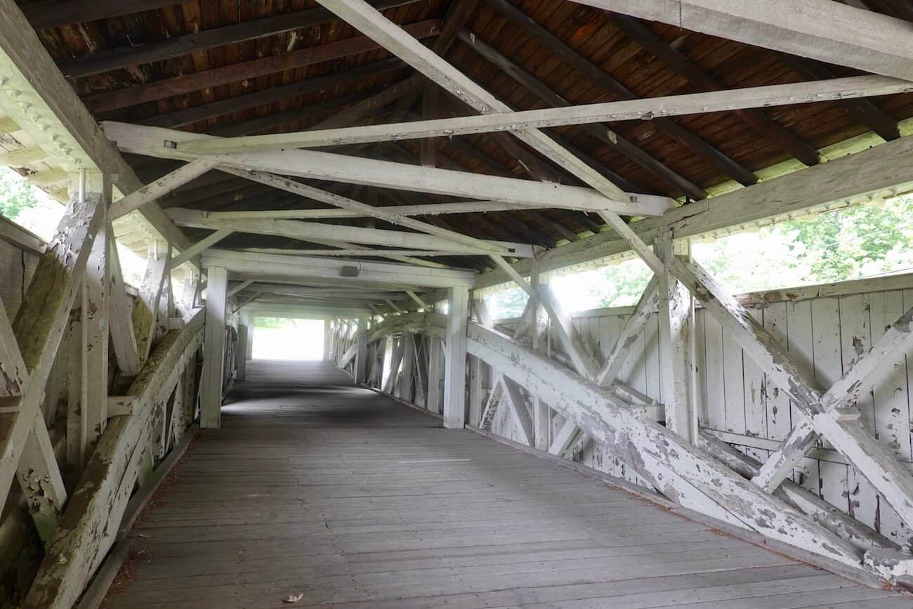
A covered bridge is wooden and covered to protect the wood from the weather. The covered bridges you’ll see today in the Lehigh Valley were built using the Burr Truss design. This design utilizes large, central arches along the sides, tied into the bridges’ abutments.
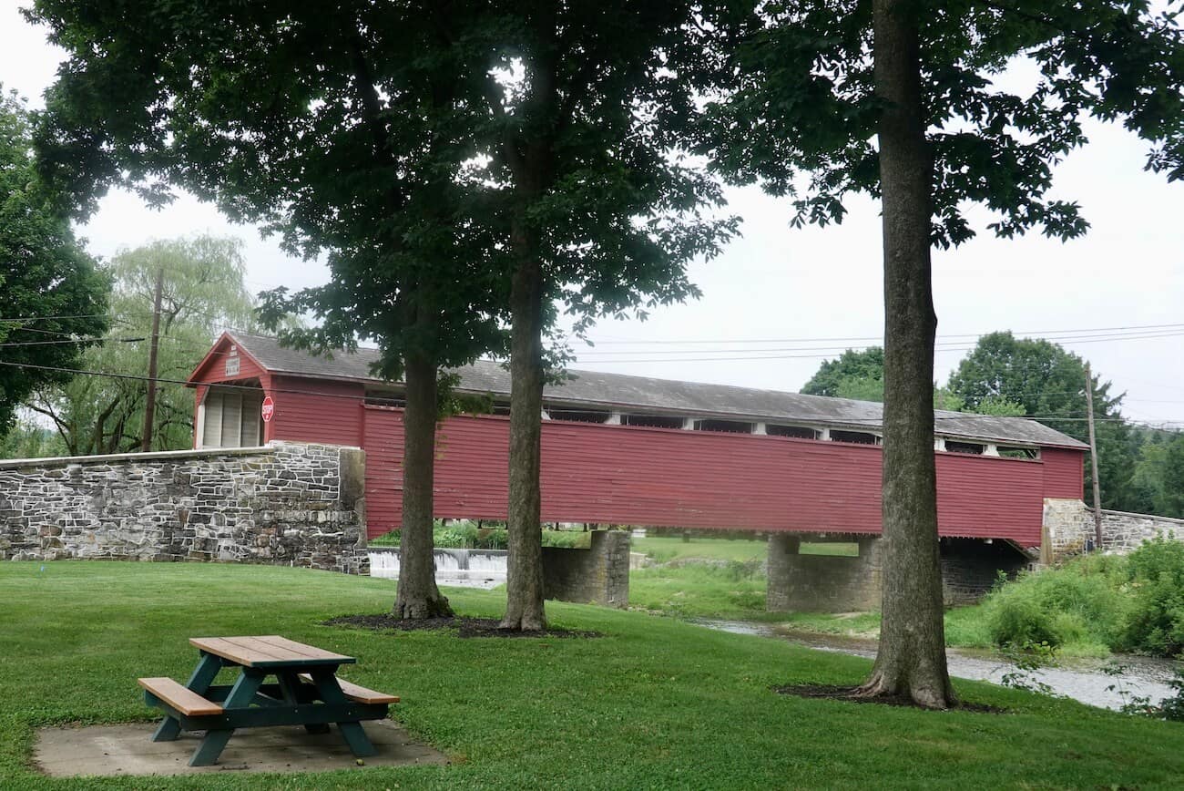
Covered bridges usually resemble barns and are painted red. It is said this helped calm horses and other animals that had to pull wagons across streams and creeks.
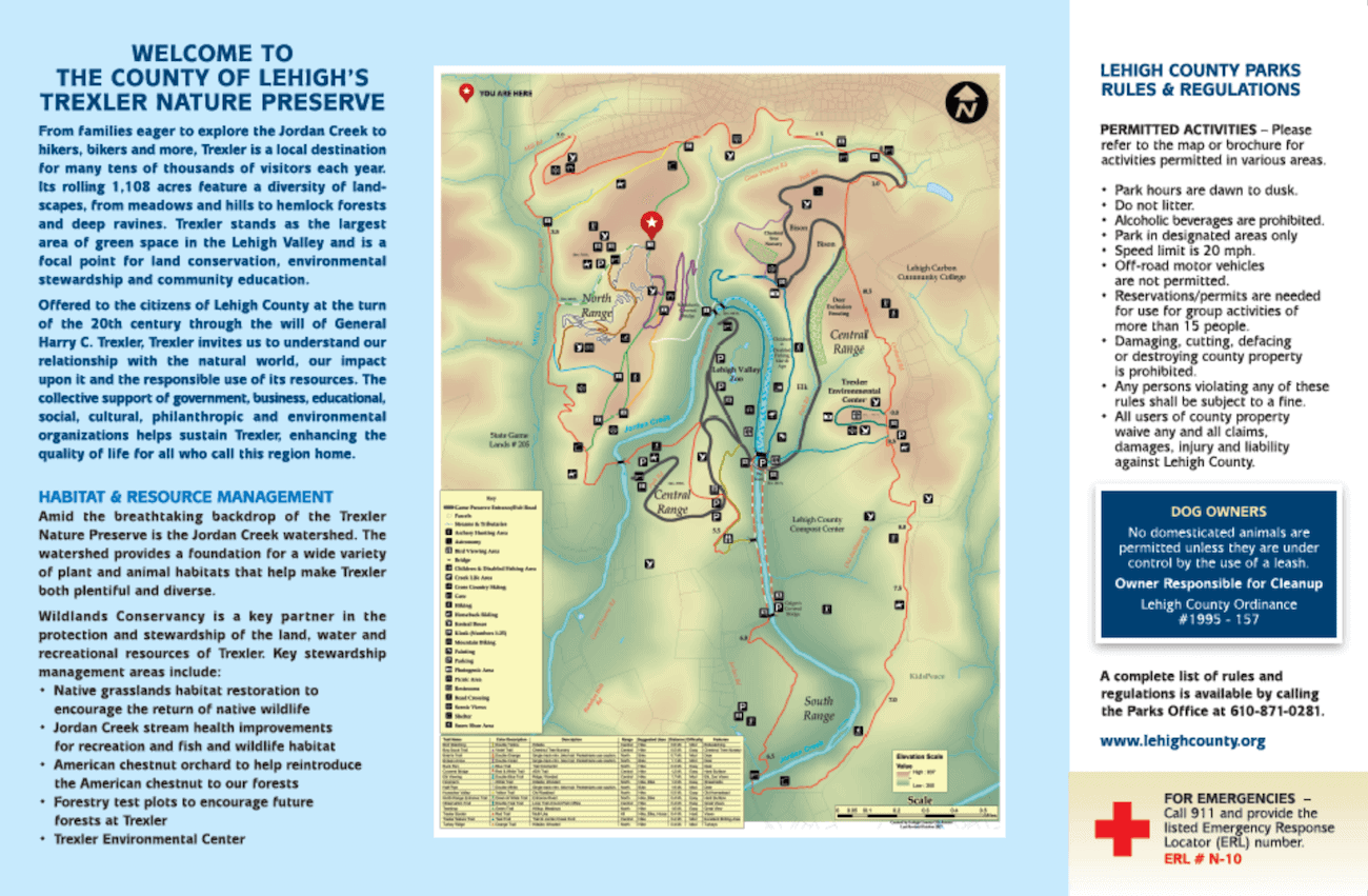
Two of the bridges (Geiger’s and Schlicher’s) are in the Trexler Nature Preserve, a sprawling 1,108-acre park in Lehigh County. Here you’ll find Lehigh Valley Zoo (admission charged) and plenty of trails, picnic areas, and scenic views. There’s no charge to enter the preserve, hike the trails, or picnic there.
Travel Tips
- Decide how much time you have for the tour. If driving to all 7 bridges, expect to spend 2 to 3 hours (depending on the time of day and traffic as well as how much time you’ll be out of your car taking pictures or exploring an adjoining park). If you don’t have that kind of time, prioritize the ones you really want to see. Maybe you only want to visit a few and then spend the rest of the time enjoying an adjoining trail or park.
- Take water along. There aren’t concessions near the bridges, so bringing water will come in handy.
- Want to pack a picnic? If so, you can enjoy it at Wehr’s Covered Bridge (at Covered Bridge Park in Whitehall) or inside Trexler Nature Preserve (in Allentown).
The following driving tour begins in Allentown, heads north to the Whitehall area, and then veers northeast to end north of Northampton.
Bogert’s Covered Bridge
Built in 1841, the first bridge on this tour is pedestrian-only. Bogert’s Covered Bridge is the longest covered bridge in the Lehigh Valley (145 feet).
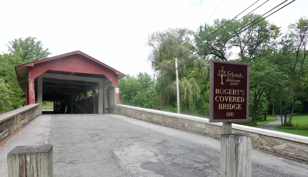
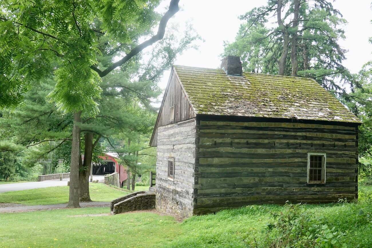
You’ll find people strolling or jogging along the trails and perhaps someone fishing along the bank. Up the small grassy hill, you’ll find a hunter’s cabin dating back to 1741 and refurbished in 1938. Also, there’s a small parking lot (with a porta-potty). This is a nice spot to stretch your legs and enjoy the bucolic scenery. [Address: Fish Hatchery Road, Allentown]
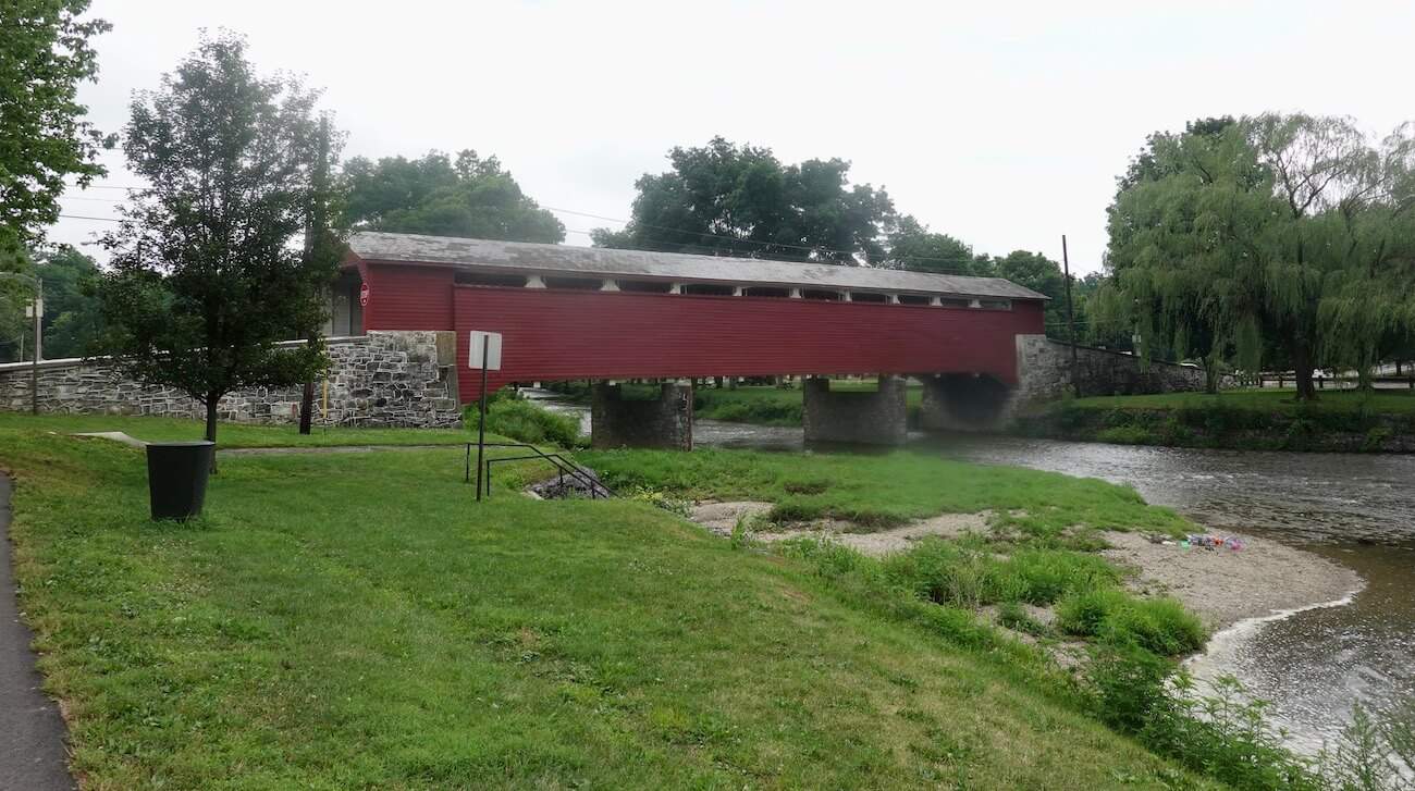
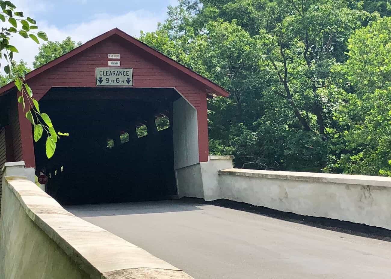
Manasses Guth Covered Bridge
On the eastern end of Covered Bridge Park is 108-foot-long Manasses Guth Bridge which was built in 1858 and crosses Jordan Creek. It was named after the first settler who lived here in the mid-18th century. It is closed and being reconstructed (in 2020). [Address: Lapp Road, Allentown]
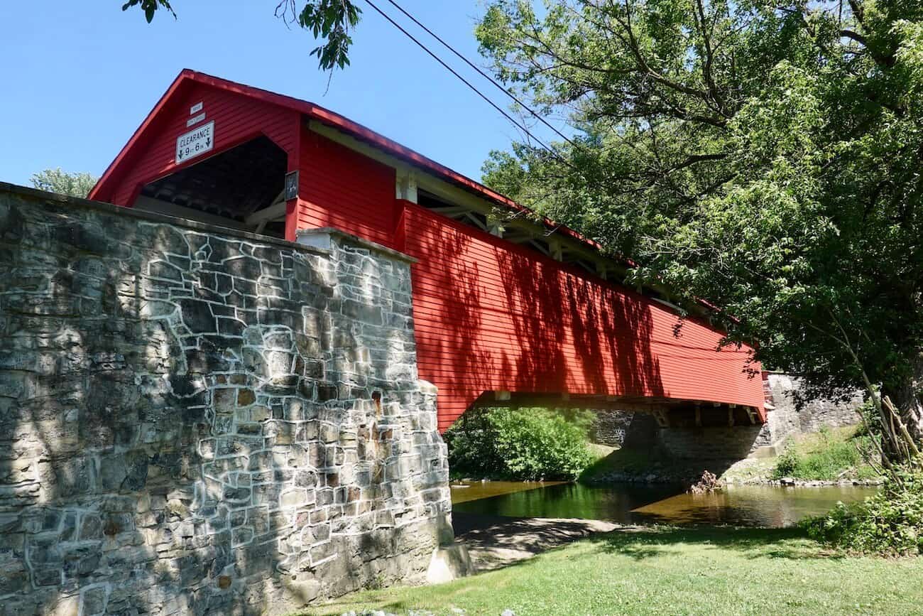
Wehr’s Covered Bridge
Wehr’s Covered Bridge is a focal point on the western side of Covered Bridge Park in Whitehall. It’s a two-lane bridge that was built in 1841 and extends 128 feet.
Plan to get out of the car and enjoy some time in the park. There are trails for walking, tables for picnicking, and Jordan Creek for fishing. Also, you’ll see a concrete dam that replaced an earlier wooden one that once supplied water for a grist mill. You’ll enjoy the sound of running water while you’re visiting here. [Address: 2503 Wehr Mill Road, Allentown]
Rex’s Covered Bridge
Built in 1858, this 116-foot bridge sees a lot of traffic as it sits just outside a housing development. [Address: 3134 Jordan Road, Orefield]
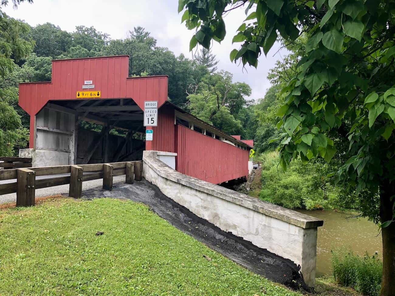
Geiger’s Covered Bridge
Located in Trexler Nature Preserve and crossing Jordan Creek, the 112-foot Geiger’s bridge was built in 1860 and sports an uncommon stepped portal entryway. There is no parking area on either side of the bridge. [Address: Old Packhouse Road, Whitehall]
Schlicher’s Covered Bridge
Also in Trexler Nature Preserve and spanning Jordan Creek, Schlicher’s Covered Bridge offers plenty of trails for hiking. Originally constructed in 1882, it was rebuilt in recent years. It is one of the shortest bridges in the area at just 108 feet long. It’s close to Lehigh Valley Zoo, and it sees a lot of car traffic. [Address: Game Preserve Road, Allentown]
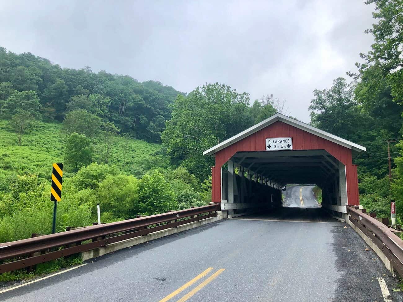
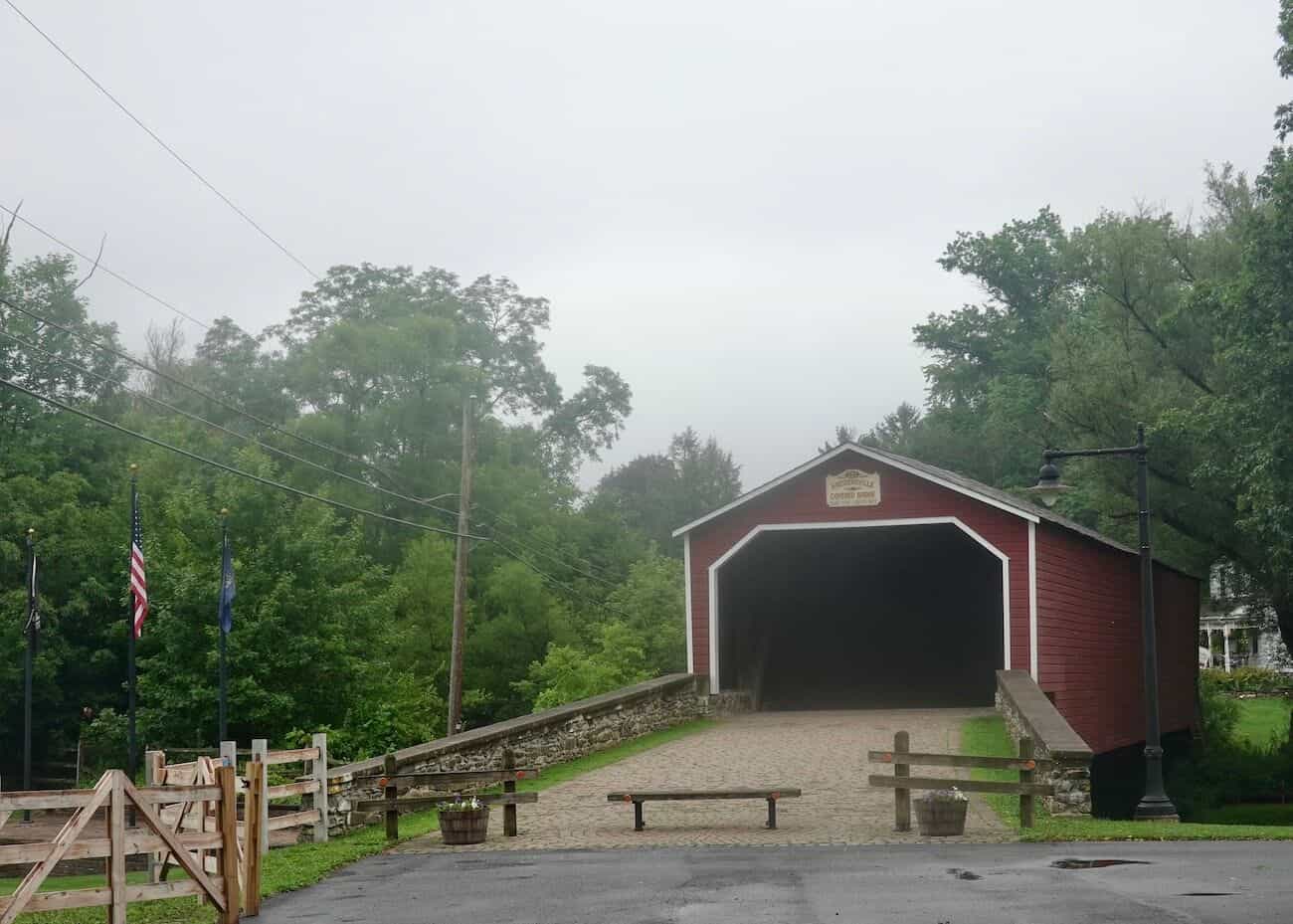
Kreidersville Covered Bridge
Constructed in 1839, this 100-foot bridge is the oldest one in the area and welcomes pedestrians (no vehicles allowed). It offers a peaceful park-like setting with a bench on the bank of Hokendauqua Creek. Unlike many other covered bridges, this one does not have any openings along its sides to let light in. [Address: 100 Covered Bridge Road, Northampton]
Map of Covered Bridges

Nearby Attractions
Check out these other great places to visit in Pennsylvania:
- Bethlehem, PA: A City Where History and Reinvention Meet, Lehigh Valley
- Big Pocono State Park, Poconos
- Bushkill Falls, Poconos
- Colonial PA Plantation, outside Philadelphia
- Covered Bridges of Bucks County
- Gettysburg Visitor Guide
- Hawk Mountain Sanctuary, Lehigh Valley
- Hickory Run State Park, Poconos
- Housenick Park, Lehigh Valley
- Jacobsburg State Park, Poconos
- John Heinz National Wildlife Refuge, outside Philadelphia
- Museum of the American Revolution, Philadelphia
- National Museum of Industrial History, Lehigh Valley
- Philadelphia Self-Guided Walking Tour
- Philadelphia: Fairmount Park’s Unique Colonial Mansions & Their Stories
- Best Things to do in Philadelphia
- Pittsburgh and Southwestern Pennsylvania Guide
- Promised Land State Park, Poconos
- Ricketts Glen State Park, Poconos
- Ridley Creek State Park, outside Philadelphia
- Tyler State Park, Bucks County
- Valley Forge National Historical Park, outside Philadelphia
- Washington Crossing Historic Park, Bucks County
Final Thoughts
Sometimes it’s nice to be reminded of simpler times, to take the time to reflect on the lives of our ancestors — and just to enjoy nature’s beauty. Driving around the Lehigh Valley, looking at the covered bridges, is one way to do that. You will probably marvel at the engineering that went into building these structures.
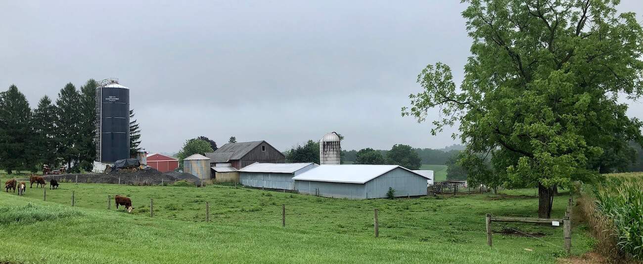
Your drive will take you past farms, along sometimes curving lanes, and certainly by some great views. And, at a few of the covered bridges, you’ll be able to stroll, hike, or bike on nearby trails. Relax and take it all in.
As mentioned, if you’re looking for other options in the Lehigh Valley, consider a visit to Hawk Mountain Sanctuary — a great place to hike and be rewarded with breathtaking vistas over the valley. Also, about an hour’s drive from the Lehigh Valley is Bushkill Falls with hiking trails around 7 waterfalls.
Comments?
Please leave a comment if you have suggestions for other places to visit in the area that readers may enjoy. Thank you! 🙂


The Lehigh Valley is such a beautiful area. I had no idea there were so many bridges left.
Yes, the Lehigh Valley is a special place, and the covered bridges help to tell a bit of its interesting history.